Phosphorus is essential for crop production, but can be lost to runoff from soil, plant residue and fertilizer and manure that’s applied to the soil surface.
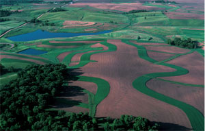
The challenge is keeping phosphorus on the land and out of the water. Farmland can be a significant source of the phosphorus that gets into lakes and streams, where it causes excess algae growth.
Here, we explain when and how to assess the risk of phosphorus loss from cropland using the Minnesota Phosphorus Index.
Excess phosphorus
Minnesota lakes and streams are a key part of the state's economy and quality of life. When excess phosphorus (P) gets into surface water, it impacts recreational uses and aquatic life.
The excess P causes increased algae growth. In turn, there’s less clear water, lower oxygen content and shading of aquatic plants that are habitats and food for fish and waterfowl.
Excess P may come from many sources including municipal and industrial waste, urban runoff, septic systems, wind-eroded sediments, stream bank erosion and runoff from feedlots and agricultural fields. On this page, we focus on runoff from agricultural fields.
Many farm fields are not significant sources of P by themselves but contribute to the cumulative P loss to Minnesota's waters. Other fields are significant individual sources of P loss. Here, we describe how to estimate P loss risk for individual fields and identify site-specific management practices likely to reduce risk.
Assessment tool overview
Factors that influence P runoff from uplands into surface water include erosion rates, manure application rates, soil test P levels and distance between the field and the surface water.
Because direct measurements of P loss are rarely practical, we use models or indicators to estimate current or future P losses under various management scenarios (Table 1). Use these major indicators to roughly identify sites likely to lose phosphorus.
Table 1: Phosphorus loss assessment tools
| NRCS 590 standards and MPCA 7020 rules* | Rapid P Index | Minnesota P Index | |
|---|---|---|---|
| Type | Indicators and practices | Indicators | Mechanistic model of three pathways |
| Uses | To control major P loss risk factors related to manure application | To reduce the number of sites where the Minnesota P Index will be applied | Farm nutrient management planning, and watershed planning to control P loss |
| Inputs | Distance to water, soil test P, erosion, filter strip, manure method and timing | Distance to water, soil test P, erosion, P fertilizer and manure rate and method | Distance to water, soil test P, erosion, P fertilizer and manure rate and method, tillage type and direction, county and crop rotation |
| Output | Manure application rate restrictions | Indicates whether field is above or below risk threshold | Relative rating of risk of P loss |
| *These are not primarily P loss assessment tools, but comprehensive feedlot and nutrient management guidelines. |
Because models are mathematical representations of systems, the quality of an estimate depends on the quantity of inputs. Users must choose between models that are quick and easy to use but only generate crude estimates, and models that generate higher-quality estimates but require far more time to learn and use.
The models in Table 1 estimate risk of P loss. More elaborate models, such as the Agricultural Non-Point Source (AGNPS) model, estimate actual P delivery. In any case, interpreting model outputs requires understanding the assumptions and research behind the model.
The simplest method for preventing P loss is to apply the requirements in the Minnesota Pollution Control Agency (MPCA) Chapter 7020 Feedlot Rules or the standards in the USDA Natural Resources Conservation Service (NRCS) 590 Nutrient Management Standard.
These two documents provide comprehensive guidance for feedlot and nutrient management. They’re not principally P loss assessment tools, but they include guidance aimed at preventing P loss and can be used to infer high-risk situations.
Manure application limits related to P loss are based on four to five indicators: Erosion rates, soil test P, distance to water, presence of vegetated buffers and method of application.
Minnesota Phosphorus Index: Using the model and understanding results
The Minnesota Phosphorus Index (Minnesota P Index) is a user-friendly model for estimating P loss risk.
How to download and use the Minnesota P Index
The Minnesota P Index is a management decision-making tool. Inputs are easily available and it generates reliable results for making farm-level decisions or for watershed planning.
Use the Minnesota P Index when a more accurate estimate is needed (e.g., on sites with multiple risk factors), or to estimate P loss risk unrelated to manure applications (e.g., to identify P loss sites within a watershed).
The index helps users identify and refine site-specific methods to reduce P loss by considering the interaction of a wide range of risk factors, including landscape characteristics, cropping and tillage practices and P application methods.
Scaling the results
The Minnesota P Index analyzes P loss risk at a field scale. However, farmers, conservationists and watershed planners manage land at a farm scale or at a small watershed scale.
You can use the index on these larger scales by comparing results for all fields in a farm or watershed, or by examining scenarios that represent the potential conditions in the farm or watershed.
For example, you can also use the index to estimate which sites are most likely to lose phosphorus and what management practices could effectively reduce risk.
Optimizing quality
The quality and usefulness of the index’s results depend on the quality of inputs. For example, the slope used to estimate erosion and the distance to surface water will significantly impact the Minnesota P Index result.
The Minnesota P Index assesses P loss risk by modeling three major pathways of P movement from fields to water: Erosion, rainfall runoff and snowmelt runoff (Figure 1).
Noting which pathway is important in a particular situation gives users information about what management changes would be most effective in reducing losses.
For each pathway, a transport mechanism is multiplied by P sources to calculate a P loss risk for that pathway. Take the sum of the three pathways to get a total P loss risk value.
Usually one pathway plays a bigger role in overall P loss risk than others. Management changes that address that pathway will be the most effective method for reducing the overall risk.

Phosphorus can travel by other pathways not considered by the Minnesota P Index, including leaching through the soil, generally a minor concern, and via wind or gully erosion, which can be significant concerns but are difficult to model at a field scale.
Like any model, getting good results requires good inputs.
Complete this data collection form to ensure you have all the information you need to run the Minnesota P Index. Two important inputs are the distance to water and the description of the field slope.
Distance to nearest surface water
The user must determine the nearest body of water where P enrichment could be a problem.
Generally, the nearest permanent stream, lake or wetland is the primary water quality concern. In addition, consider any drainage ditch or other watercourse to be the nearest surface water if it’s wet most of the year.
If all the phosphorus reaching a watercourse is likely to travel to a lake or stream, then consider that watercourse to be the “nearest water” for the purpose of estimating P loss risk. If there’s no concern about the water quality in a closed depression (i.e., water with no connection to other surface water), then don’t consider it as the nearest surface water.
Although some consider surface tile inlets a direct conduit to surface water, do not use inlets as the nearest surface water in the Minnesota P Index. Instead, indicate the presence of depressions with inlets. Due to their different method of P delivery, the program accounts for inlets and overland runoff separately.
Slope length and gradient
Erosion is an important cause of phosphorus loss, so a good erosion estimate is critical to generating a good P loss risk estimate. The Minnesota P Index program uses the Revised Universal Soil Loss Equation 2 (RUSLE2) model to estimate erosion. An important input into RUSLE2 is the description of a cross-section of a slope in the field.
The results of the Minnesota P Index estimate the relative risk of a field being a source of phosphorus pollution to a nearby body of water.
Results aren’t quantitative estimates of P delivery, although they correlate with P delivery. Table 2 shows how low, medium and high risk can be defined, but the user may adjust these depending on objectives and the receiving water’s sensitivity.
Results aren’t quantitative estimates of P delivery, although they correlate with P delivery. Table 2 shows how low, medium and high risk can be defined, but the user may adjust these depending on objectives and the receiving water’s sensitivity.
| Total P Index | Risk rating | Recommended response |
|---|---|---|
| 0 to 1 | Very low risk | No management changes are recommended. |
| 1 to 2 | Low risk | Minor management changes are recommended. |
| 2 to 4 | Medium risk | You may need small management improvements to lower P loss risk. Avoid practices that increase P loss risk. |
| 4 to 6 | High risk | Moderate improvements in management are recommended. |
| More than 6 | Very high risk | Multiple and possibly large improvements in management practices recommended. |
Minnesota P Index results represent the relative risk of P loss. For example, a doubling of the risk value suggests P delivery is likely to double given the same set of weather events.
Do not use the results to quantify actual P delivery. Instead, compare the relative delivery from different management scenarios. The Minnesota P Index is a model of transporting P to surface water, so it doesn’t predict its effect on water quality once it enters the stream or lake.
Minnesota P Index strengths are how it compares the level of risk between sites, determines how management practices affect P loss risk and assesses the interaction of risk factors that may not seem significant when considered alone.
In addition to the total result, note which pathway – erosion, rainfall runoff or snowmelt – contributes most to P loss risk. This will allow you to identify which management practices will effectively reduce risk (Figure 2).
After identifying a suitable management change, use the Minnesota P Index program to test the effect of the management change on P loss risk.
Sediment-bound P losses: How to reduce risk
-
Decrease erosion by reducing tillage and increasing crop residue cover.
-
Add sediment traps such as buffer strips.
-
Reduce or prevent high soil test P levels.
Soluble P losses in rainfall runoff: How to reduce risk
-
Decrease runoff by increasing surface cover, increasing infiltration and by growing forages and other permanent vegetation.
-
Reduce manure application rates.
-
Incorporate or inject all manure and fertilizer.
-
Reduce or prevent high soil test P levels.
Snowmelt runoff P losses: How to reduce risk
-
Don’t apply manure to frozen ground.
-
Leave soil surface rough in the fall and till across the slope rather than up and down. Although you can reduce P lost in snowmelt through more aggressive fall tillage, burying most of the crop residue is not recommended. This is because you’ll need residue after planting to prevent erosion and P loss by the other two pathways.

The Minnesota P Index does not account for non-agricultural P losses, losses due to leaching or losses due to gully or wind erosion.
Leaching losses are normally insignificant, but may be a concern on coarse, irrigated soils where soil test P or P applications are very high or on fractured soils with preferential flow channels that minimize the interaction of water with soil.
Minnesota P Index results correlate with P delivery but don’t indicate the absolute amount of P that will be delivered to surface water. The relative risk ratings support decisions about whether a management change will substantially impact reducing P losses. Risk ratings, however, do not allow direct comparisons to other sources of P such as municipal waste discharge.
The Minnesota P Index does not indicate changes in surface water quality because it doesn’t consider sensitivity of the receiving waters, sources of P such as municipal and commercial waste or P-rich sediments previously deposited in the lake or stream.
The index doesn’t consider the environmental costs of P delivery to surface waters, nor the cost of adopting different practices to reduce P losses from specific fields.
How to assess P loss risk
The method of P loss risk assessment differ for a farm manager planning practices that don’t threaten water quality, and a watershed planner identifying and addressing sources of P to a lake or stream.
Farm manure and nutrient management
Planning the location, timing and method of manure application should begin with state (MPCA) regulations outlined in Applying Manure in Sensitive Areas. This document is based on the MPCA Chapter 7020 Feedlot Rule and the NRCS 590 Nutrient Management Standard.
The MPCA rules pertain to anyone applying manure, while NRCS standards are used by producers enrolled in NRCS-administered conservation programs and others who have requested nutrient management assistance. NRCS standards and MPCA rules consider nitrogen and pathogen concerns along with phosphorus.
After using the MPCA rules and NRCS standards, use the Minnesota P Index, which gives producers more flexibility in some situations.
For example, for the largest category of livestock farms, manure applications generally aren’t allowed in the winter or on soils testing extremely high in P unless the field is at least 300 feet from lakes and streams and it uses additional practices to reduce P movement. In these situations, producers can use the Minnesota P Index to demonstrate P loss risk is low.
For more details about how to use the Minnesota P Index in these contexts, see the MPCA 7020 Rule and the NRCS 590 Standard.
Watershed risk assessments
Phosphorus loss risk assessment for a watershed involves two levels of effort.
First, assess the use of good stewardship practices that keep P on cropland and out of water. These include runoff and erosion control practices and using the nutrient management practices – such as soil testing, applying fertilizer and manure at agronomic rates, timely incorporation and appropriate setbacks – recommended by the University of Minnesota.
The second level of assessment is identifying specific sites that may be the source of relatively higher amounts of P to a lake or stream.
You can use the Minnesota P Index to identify high-risk sites and determine the management changes that will effectively reduce P loss from both high- and low-contributing sites.
The Minnesota P Index is a field-scale assessment tool, so don’t use watershed-scale inputs and don’t sum index results across a watershed. Use the index in tandem with other measurements and models that assess P loss for the whole watershed.
By using the Minnesota P Index in either of the two ways described below, you can determine the relative impact of various fields and practices on P delivery within a small watershed.
High-risk sites
Generally, a site with a Minnesota P Index value over four has a high risk of P loss.
You can set a different threshold depending on your objective and the sensitivity of the receiving water. A threshold of two or three may be appropriate if a lake or stream is highly sensitive to P or if watershed planners aim to eliminate nearly all P inputs.
Step 1: Choose sites by using the Rapid Phosphorus Index to identify the low-risk fields.
Step 2: Use the Minnesota P Index to calculate P loss risk for the remaining fields across the watershed.
Step 3: Examine the sites with high P loss risk. What proportion of the total sites have elevated risk? What factors are causing the higher risk?
Step 4: Test proposed solutions. For example, rerun all the scenarios assuming that a specific best management practice was adopted. Would there be significantly fewer high-risk sites?
Step 5: Monitor changes in the number of high-risk sites over time.
Step 1: Consider the variety of landscapes and cropping systems in the watershed. For each input to the Minnesota P Index program, define a range of attributes that represents the watershed. For example, there may be two or three major types of soils and landscapes, a few crop rotations, two main tillage systems and a couple of manure and fertilizer practices.
Step 2. Run the Minnesota P Index program on scenarios using the defined input ranges.
Step 3. Examine results by using the “Export scenario data” function in the “File” menu. Which scenarios have the highest P Index? What factors or combinations of factors are most important in determining P loss risk in this watershed? For example, perhaps moderate manure applications are only a problem on one landscape type.
Step 4. Target the factors identified in Step 3 during data collection, monitoring and education.
Education
You can use the Minnesota P Index to help explain the movement of phosphorus across the landscape and illustrate the effect of various management practices.
Here are some examples of educational uses:
-
Run scenarios in the Minnesota P Index program with an individual or group of land managers. Allow them to choose the management inputs. Show how the changes do or do not affect the P loss risk estimate.
-
Use the Reports function in the program to create graphs comparing the effect of alternative management practices for your local soils and cropping systems. Illustrate the effect of how multiple P loss risk factors interact.
-
Use diagrams of the Minnesota P Index model to explain sources and transport of phosphorus.
Critical P sources
Estimates of erosion and P loss risk represent the whole field, yet only a single runoff path in the field is used to estimate erosion.
This is appropriate because sediment and phosphorus are not evenly lost from all parts of a field, but come from a few critical source areas called the “most limiting areas of significant extent,” according to the Minnesota NRCS.
The “most limiting areas of significant extent” are the areas of the field that most limit management because they have the greatest risk of erosion.
Efforts to characterize and treat of the field should focus on those critical areas, which are generally the areas with the steepest slope. “Of significant extent” means the “most limiting area” selected should represent the characteristics of at least 20 percent of the field.
After identifying the “most limiting area of significant extent,” determine the soil type(s) and define the length and percent of slope(s) for this area.
The slope length begins where overland flow originates and the ends where concentrated flow begins. Specifically, the location where the sides of a hillslope intersect to collect overland flow in defined channels, such as grassed waterways or gullies.
This hillside may contain several slope segments, such as a gentle gradient near the top of the hill, a steeper side slope, and then a gentler toe slope. Estimate the length and gradient of each slope segment, or determine a typical slope gradient and length for the soil type. Typical slope information is available from your local NRCS Service Center.
Sediment delivery value vs. soil loss value
People familiar with the Revised Universal Soil Loss Equation 2 (RUSLE2) model should note that the Minnesota P Index uses the sediment delivery value, not the soil loss value. Both are estimates of erosion.
Soil loss value measures soil movement within the field and is used for conservation planning. Sediment delivery value measures the soil delivered to the edge of the field or to the end of the defined runoff pathway. Sediment delivery may be less than soil loss if a toe slope is included where some of the soil is deposited.
This is why it’s sometimes important in the Minnesota P Index to model a complex slope with multiple sequential slopes in the defined runoff pathway.
Do not use RUSLE2 sediment-delivery numbers from the Minnesota P Index for conservation planning. Numbers may either be lower than soil loss values when using a complex slope in the Minnesota P Index, or higher than values generated in the RUSLE2 program because the Minnesota P Index simplifies the inputs to RUSLE2.
The rapid phosphorus index
The Rapid Phosphorus Index (RPI) is a set of indicators and thresholds based on the Minnesota P Index.
It’s less powerful but quicker to use than the Minnesota P Index. While the Minnesota P Index is easy to learn and use, it requires a modest amount of time to collect input data.
When you need to analyze many fields, you can use the Rapid Phosphorus Index (RPI) as a screening tool. It will help you quickly eliminate the lowest-risk sites or focus on the highest-risk sites where you’ll apply the Minnesota P Index.
The RPI is a set of indicators and thresholds based on the Minnesota P Index. It will identify high risk attributable to major risk factors, but will not assess interactions among multiple factors.
Inputs needed for the RPI include estimates of:
-
Manure and fertilizer application rates.
-
P application method.
-
Soil test P.
-
Erosion rates.
-
Distance to water.
-
Quality of soil drainage.
The RPI consists of three separate tools of varying sensitivity; choose any one of them.
Use the high-sensitivity version to eliminate only the lowest-risk sites and the low-sensitivity version to eliminate all but the very highest-risk sites.
If any of the criteria are met in any year of the rotation, then run the full Minnesota P Index on the field to calculate a more reliable P loss risk estimate.
If the site meets any of these criteria, the total P index may be greater than two.
-
Any amount of unincorporated manure or fertilizer.
-
More than 100 pounds of P2O5 per acre per year of incorporated manure and/or fertilizer.
-
Soil test P is greater than 100 ppm (Olsen) and soil loss is greater than 3 tons per acre per year.
-
Soil test P is greater than 100 ppm (Olsen) and infiltration is slow (i.e., Hydrologic Soil Group is C or D, or soil is clay or clay loam and without artificial drainage).
-
Erosion is greater than 8 tons per acre per year.
-
Distance to water is greater than 100 feet and erosion is greater than 5 tons per acre per year.
-
Distance to water is greater than 10 feet and erosion is greater than 3 tons per acre per year.
If the site meets any of these criteria, or two of the criteria in the high-sensitivity tool, the Total P index may be greater than four.
-
More than 100 pounds of P2O5 per acre per year of unincorporated manure and/or fertilizer.
-
More than 200 pounds of P2O5 per acre per year of incorporated manure and/or fertilizer.
-
Soil test P is more than 100 ppm (Olsen) and soil loss is greater than 3 tons per acre per year.
-
Erosion is greater than 10 tons per acre per year.
-
Distance to water is more than 100 feet and erosion is greater than 6 tons per acre per year.
-
Distance to water is more than 10 feet and erosion is more than 4 tons per acre per year.
If the site meets any of these criteria, or two of the criteria in the moderate sensitivity tool, the total P index may be greater than six.
-
More than 200 pounds of P2O5 per acre per year of unincorporated manure and/or fertilizer.
-
More than 200 pounds of P2O5 per acre per year of incorporated manure and/or fertilizer and erosion is more than 4 tons per acre per year.
-
Erosion is more than 10 tons per acre per year.
Distance to water is more than 10 feet and erosion is more than 6 tons per acre per year.
Reviewed in 2018