VRI: how it works and how growers can benefit
Most fields are more variable than they appear. Differences in soil types, textures, organic matter, elevation, and drainage strongly influence how quickly soil dries after irrigation or rainfall. When a uniform irrigation rate is applied across these variable conditions, some areas receive more water than needed, while others experience water stress.
Variable Rate Irrigation (VRI) is a precision irrigation approach designed to address this problem. By adjusting water application depth across different parts of the field, VRI allows growers to better match water application to local soil and crop conditions.
This article provides an overview of VRI, how it works with center-pivot systems, the types of VRI available, and how prescription maps are developed. The goal is to provide a practical, accessible guide for anyone interested in improving irrigation management with VRI.
Why VRI matters
VRI is becoming increasingly relevant as weather patterns become more variable and irrigation input costs continue to rise. Fields with noticeable differences in soil texture, slope, or drainage benefit most because a single uniform rate often results in uneven water distribution.
In these fields, VRI can:
- Reduce overwatering and waterlogging.
- Protect sandy or elevated areas from crop stress.
- Improve irrigation efficiency and reduce energy use.
- Reduce nutrient leaching risk in sensitive zones.
- Support more uniform crop development across the season.
The value of VRI is highest where field variability is persistent and well-defined.
When VRI may not be needed
Not every irrigated field will benefit from Variable Rate Irrigation. Fields with relatively uniform soils, minimal elevation change, and consistent crop performance often see limited improvement from VRI compared to well-managed uniform-rate irrigation.
In these situations, improving irrigation scheduling, system maintenance, and application timing may provide greater returns than investing in VRI hardware or software. VRI is most effective in fields where spatial variability is persistent, well-defined, and repeatable across seasons.
What you need to get started with VRI
Basic requirements:
- A center pivot equipped with VRI capability.
- Field variability information (soil EC maps, NDVI imagery, soil data, elevation).
- A basic understanding of Management zones.
- A prescription map software (e.g., Reinke, Valley VRI Commander, Agsense).
- Ability to upload a prescription file to the pivot panel.
- Irrigation scheduling tools such as the Irrigation Management Assistant (IMA) tool, checkbooks, or soil moisture sensors.
Types of Variable Rate Irrigation (VRI) Systems
Variable Rate Irrigation systems differ in how precisely they control water application along the center pivot. The level of control determines how finely irrigation depth can be adjusted across the field, as well as system cost and complexity. The three most common VRI approaches are described below.

Speed-Control VRI
Speed-control VRI adjusts irrigation depth by varying the pivot’s travel speed. When the pivot moves more slowly, more water is applied; when it moves faster, less water is applied. The irrigation rate is uniform across the entire pivot span at any given time.
This approach is the simplest and lowest-cost form of VRI. However, because the entire pivot speeds up or slows down together, speed control cannot address variability across the field width at the same pivot position. As a result, it is best suited for fields with limited spatial variability or situations where only broad changes in irrigation depth are needed.
Zone-Control VRI
Zone-control VRI divides the pivot into management zones, typically by grouping multiple sprinklers together along the pivot span. Each zone is controlled by electronic valves that turn water on or off as the pivot moves through different parts of the field.
This approach allows different irrigation depths to be applied simultaneously across zones of the field, making it well-suited for fields with distinct soil- or landscape-driven variability. Zone-control VRI is widely available and represents a balance between precision, cost, and management complexity. Most commercial VRI systems installed today fall into this category.
Sprinkler-level (individual nozzle) VRI
Sprinkler-level VRI provides the highest precision by controlling individual sprinklers or small groups along the pivot. Each nozzle can be turned on or off independently, allowing irrigation depth to be adjusted at a very fine spatial resolution.
This level of control is especially useful in fields with highly variable soils, irregular field shapes, or specialty crops where precise water management is critical. However, sprinkler-level VRI requires more complex hardware, additional wiring or control components, and a higher upfront investment. It also demands careful system design and maintenance.
How Variable Rate Irrigation works in the field

VRI allows different irrigation depths to be applied to different parts of a field during the same irrigation event.
Unlike conventional center-pivot irrigation, which applies at a uniform depth across the entire pivot circle, VRI uses field-specific information to adjust application rates spatially as the pivot moves.
The VRI process begins with identifying spatial variability within a field. Many irrigated fields contain a mix of sandy areas that dry quickly and heavier or lower-lying areas that retain water longer.
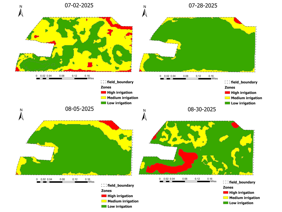
This variability is commonly characterized by using soil electrical conductivity (EC), elevation, soil texture information, historical yield data, and crop imagery such as NDVI. These data layers are used to delineate management zones, the areas of the field that are expected to behave similarly with respect to soil water storage and crop response.
Once management zones are established, irrigation depths are assigned to each zone through a prescription map. The prescription specifies the amount of water to be applied to each zone during an irrigation event.
This prescription file is uploaded to the pivot controller, which uses GPS-based position tracking to determine the pivot’s location in the field and applies the assigned irrigation depth as it moves through each zone.
Water applications are controlled by pivot hardware, such as electronic valves or solenoids, which regulate flow to sprinkler groups or individual nozzles, depending on the VRI system design. In zone-control systems, groups of sprinklers are turned on or off as the pivot enters different zones. In more advanced systems, individual sprinklers can be controlled independently, allowing finer spatial control of irrigation depth.
Throughout the season, prescription maps may remain static or be updated dynamically. Static prescriptions are based on stable field characteristics such as soil texture, EC, and elevation, and are often used as a baseline irrigation strategy.
On the other hand, dynamic prescriptions incorporate information that varies over the season, such as NDVI imagery or soil moisture measurements, enabling prescription maps to be adjusted in response to evolving crop conditions.
Regardless of the software used, VRI systems apply irrigation according to the provided prescription map. The technology determines where water is applied differently, but it does not determine how much water the crop needs. That decision requires an understanding of soil water-holding capacity, rooting depth, crop water demand, and current soil moisture conditions.
Zones define where, not how much
Most VRI software platforms are effective at delineating the field into management zones using spatial data. However, zone delineation alone does not determine appropriate irrigation depth. Assigning irrigation amounts requires field knowledge and supporting tools such as soil moisture sensors or irrigation scheduling models that track soil water balance over time.
Successful VRI implementation depends on integrating spatial zone maps with irrigation scheduling decisions. Without this integration, even well-defined zones can result in over-irrigation in some areas and water stress in others.
Software and services for creating VRI management zone maps
Several software platforms are available to support the creation of VRI management zones using field information such as soil maps, elevation, NDVI imagery, and yield data. These tools range from pivot-integrated platforms designed for ease of use to more advanced mapping software commonly used by consultants and researchers. Most VRI software options are commercial (paid) products, typically provided through hardware purchases, subscriptions, or service agreements.
The examples below are provided for informational purposes only. This is not a complete list, and mention of specific companies or platforms does not imply endorsement by the University. Growers are encouraged to work with their local dealers or service providers to determine which tools best fit their systems.
These platforms are designed to work directly with center-pivot irrigation systems and are often the easiest option for growers to adopt.
Valley Irrigation – Valley VRI Commander: Allows users to create and upload zone-based irrigation prescriptions using soil maps, elevation, or NDVI imagery. The system integrates directly with the pivot controller and supports both static and updated prescriptions during the season. Access is typically included through paid hardware or service packages.
Reinke Manufacturing – Reinke VRI Software: Supports speed-control and zone-control irrigation. Users can define management zones manually based on soil maps, yield histories, or by importing external spatial data layers. The software is commonly provided through Reinke dealers as part of a paid system upgrade or service agreement.
Lindsay Corporation – FieldNET Advisor / FieldNET VRI: Supports VRI implementation by allowing users to manage irrigation prescriptions, monitor pivot performance, and integrate field data layers. VRI functionality is available through FieldNET subscriptions and compatible Zimmatic pivot systems, making it a commonly used option for growers operating Lindsay equipment.
AgSense: Primarily serves as a communication and monitoring platform rather than a traditional zone-creation tool. It allows users to upload VRI prescriptions created in other software, monitor pivot operation, and verify the irrigation depths applied through remote access. Newer versions of AgSense 365 also allow users to import GIS-based files and manually create or adjust management zones within the platform, providing additional flexibility for managing VRI prescriptions. AgSense is offered through subscription-based plans.
These pivot-integrated platforms are often recommended as entry-level options for VRI because they require minimal GIS experience and align closely with pivot hardware.
More advanced software platforms provide additional analytical tools for creating management zones, but typically require more experience.
SMS Ag Leader: Widely used by consultants and advanced producers to develop management zones using yield data, soil EC, elevation, and imagery. It is a paid software platform and is commonly used in consulting or service-based workflows.
Climate FieldView: An intuitive interface for exploring satellite imagery and yield data to identify within-field variability. It can support VRI zone development, particularly where variability is crop-driven. FieldView operates on a subscription basis.
QGIS: A free, open-source GIS platform capable of detailed spatial analysis and custom zone development. While it provides maximum flexibility, it has a steeper learning curve and is more commonly used by researchers or trained consultants than by growers without GIS experience.
Esri-ArcGIS: Widely used in research and professional consulting to combine soil, elevation, imagery, and yield data into management zones. It offers advanced spatial analysis capabilities, but is a commercial GIS platform and not typically used directly by growers.
Script-based tools (Python and R) are increasingly used by researchers and advanced consultants to automate and standardize management-zone delineation across multiple fields using soil, elevation, yield, and imagery data. These approaches offer high consistency and scalability but require programming and GIS expertise and are not typically used directly by growers.
Some platforms, such as CropX, offer a sensor-integrated approach to VRI. By combining real-time soil moisture data from in-field sensors with satellite imagery and topography, these tools can automate the creation of irrigation prescriptions. This reduces the manual work of delineating zones and allows for dynamic adjustments based on actual soil water status throughout the season.
In addition to software platforms, many growers rely on service providers to develop VRI management zones and irrigation prescriptions. These services are commonly offered by:
- Irrigation equipment dealers
- Precision agriculture consultants
- Agronomy service providers
Service-based approaches can reduce the technical burden on growers and are especially useful during early stages of VRI adoption or in highly variable fields. In these cases, management zones and prescriptions are developed externally and delivered directly to the pivot system.
Most VRI software platforms are effective at delineating fields into management zones using spatial data such as soil EC, elevation, yield maps, or NDVI imagery. However, zone delineation alone does not determine the amount of water to be applied in each zone.
Deciding irrigation depth requires an understanding of soil water-holding capacity, crop water demand, and current soil moisture conditions. For this reason, VRI prescriptions are most effective when zone maps are paired with soil moisture sensors, irrigation scheduling tools such as the Irrigation Management Assistant (IMA) tool, or a field water balance approach such as the checkbook method. These tools help determine when irrigation is needed and how much water each zone can safely store without causing stress or leaching.
Successful VRI implementation depends not only on software but also on field knowledge. Growers and consultants must understand their soils, rooting depth, and available water-holding capacity to assign appropriate irrigation depths to each zone. Without this context, even well-defined zones can result in over- or under-irrigation.
Benefits and practical considerations of Variable Rate Irrigation
Research conducted in Minnesota and other irrigated regions has shown that precision irrigation, including Variable Rate Irrigation (VRI), can improve irrigation efficiency and reduce unnecessary water application in fields with meaningful soil variability.
A University of Minnesota Extension case study demonstrated that adjusting irrigation rates across a field based on soil and landscape differences reduced overwatering in wetter areas while maintaining adequate water supply in sandier zones, resulting in improved water-use efficiency without yield loss.
Results from a VRI study on the central sands of Minnesota showed that redistributing irrigation water based on soil variability and water-holding capacity reduced excess application in wetter areas while maintaining adequate soil moisture in sandier zones, without compromising crop yield. Rather than increasing total irrigation, VRI improved how water was allocated within the field, highlighting that the primary benefit of VRI lies in improved water-use efficiency and risk reduction when irrigation decisions are aligned with soil properties and crop demand.
In fields with high variability, VRI can support more uniform crop growth by reducing early-season water stress in drier areas and limiting excess water in low-lying or finer-textured zones. By more closely matching irrigation depth to soil water-holding capacity, growers can improve stand uniformity, make better use of irrigation capacity during peak-demand periods, and reduce the risk of nutrient leaching in sensitive areas.
At the same time, both studies emphasize that VRI benefits depend on management decisions rather than technology alone. Successful outcomes required realistic management zones, accurate field data, and irrigation scheduling approaches that accounted for soil moisture conditions and crop water demand. VRI systems determined where irrigation rates differed, while soil and scheduling knowledge determined how much water was applied.
VRI is not a universal solution. Economic returns are greatest in fields with clear and persistent spatial variability, and adoption requires investment in hardware, software, or service support. Poor-quality spatial data or misaligned prescriptions can limit benefits, and additional planning and system maintenance are required. Fields with relatively uniform soils may see limited improvement from VRI, whereas fields with strong variability offer the greatest opportunity for improved efficiency and more consistent crop performance.
Evans, R. G., & Sadler, E. J. (2008). Methods and technologies to improve efficiency of water use. Water Resources Research, 44(7), 1–15.
Evans, R. G., LaRue, J., Stone, K. C., & King, B. A. (2013). Adoption of center pivot variable-rate irrigation systems. Irrigation Science, 31, 871–887.
Kechchour, A., Miao, Y., & Sharma, V. (2025). Evaluating the benefit of integrated precision nitrogen and irrigation management for maize in Minnesota. Department of Soil, Water and Climate, University of Minnesota, St. Paul, MN, United States. https://brill.com/edcollchap-oa/book/9789004725232/BP000161.xml
Lo, T., Chávez, J. L., & Khosla, R. (2020). Quantifying the impact of variable-rate irrigation on water use efficiency. Agricultural Water Management, 227.
Sharma, V., & Herbert, T. (2023). Comparison of Variable Rate Irrigation (VRI) to Uniform Rate Irrigation for impacts on groundwater quality and quantity. Minnesota Department of Agriculture Greenbook 2023. Pages 88-97. https://www.lrl.mn.gov/docs/2023/other/231799.pdf
Stone, K. C., et al. (2023). Field-scale evaluation of VRI for improving irrigation uniformity and water use. Journal of Irrigation and Drainage Engineering.
Reviewed in 2026