Forests and water quality
Clean water is one of Minnesota's greatest natural resources. Many of our water resources, such as lakes, rivers and streams, originate in forested areas. Woodlands help maintain water quality by keeping soil in place, storing nutrients and balancing water flows. They also help moderate stream water temperatures to support healthy fish populations.
Managing woodlots can affect water quality
Whether your woodlot is 5 acres or 100 acres, managing it can require road building, timber harvesting and mechanical site preparation. Any of these activities can adversely affect the quality of adjacent waters if not properly planned or conducted.
The biggest concern for managing woodlots near lakes, streams or wetlands is soil eroding and ending up in surface waters. The amount of soil erosion and sedimentation depends on soil type, steepness of slopes, rainfall and the amount of soil that has been disturbed or exposed by management activities.
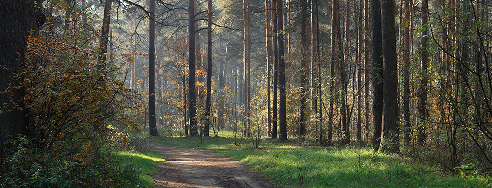
Filter strips are necessary
A filter strip is an area of vegetation next to a water body where management activities are kept to a minimum (so that less than 5% soil is exposed). This strip should be created between the shoreline (the ordinary high water level) and the area to be managed. Management is permitted in the filter strip if it doesn't disturb the soil. Minimizing the exposure of soil and maintaining the vegetation will help trap sediment and allow runoff to seep into the soil before it reaches surface water.
The width of the filter strip depends on slope steepness (percent slope), slope length and soil type. In general, the steeper the slope, the wider the filter strip should be. For more erodible soil, the filter strip should be wider. Recommended widths of filter strips for woodlot management are given in Table 1.
Table 1: filter strip width guide for woodlot management.
| Slope of land between management activity and water body (percent) | Recommended width of filter strip (slope distance in feet)* |
|---|---|
| 0-10 | 50 |
| 11-20 | 51-70 |
| 21-40 | 71-110 |
| 41-70 | 111-150 |
*Distance is measured to the edge of soil disturbance, or in the case of fills, from the bottom of the fill slope.
Have a management plan
Get advice and assistance in preparing a management plan from:
- Regional Department of Natural Resources (DNR), Division of Forestry.
- Local Soil and Water Conservation District (SWCD).
- Local forest industries.
Individuals can also contract with a private consulting forester. Cost-sharing programs may be available to assist woodlot owners with some management activities.
Resources that are useful in preparing a management plan include:
- Soil surveys.
- Soil maps.
- Topographic maps.
- Aerial photos.
- Thorough on-site examination of the area.
Best management practices (BMPs)
Forest roads
Erosion that occurs during forest road construction has the greatest potential to degrade lakes, streams and wetlands. An important first step is to determine how the roads will be used now and in the future. To minimize road construction, roads should be built to the maximum standards needed to meet expected uses.
Follow these best practices:
- Design roads in locations with lowest slope.
- Use barriers, such as silt fencing and hay bales, where siltation and erosion may occur. Mulch and seed exposed soils.
- Where the road must cross a stream, contact the DNR Division of Waters to determine if a protected water permit is needed.
- Minimize the number of times a road crosses open water or wetlands.
- Low water crossings (driving through open water) are not recommended.
- Water crossings using a culvert or bridge should cross a stream at a 90° angle to the stream bed in areas where the stream edge is stable.
- Use properly sized culverts or bridges where necessary.
- Remove any temporary culverts or bridges after the road is abandoned.
- Design roads for maximum cross drainage using water diversion structures (e.g., water bars) to minimize down road flow.
- Close all temporary roads after use to prevent unwanted use by off-road vehicles that could be detrimental to the site.
Upland timber harvesting
Timber harvesting, central to woodlot management, involves cutting trees and removing them from the site. Since harvesting temporarily disturbs the environment, it should follow a plan that includes water quality protection at all stages:
- Time the harvest for the least soil disturbance by considering soils, topography and weather conditions. Soil disturbance is generally greatest under wet conditions and least under frozen conditions.
- Locate landings (areas where harvested trees are brought for processing) away from low, poorly drained areas and outside of filter strips.
- Never deposit harvesting slash (tree tops, branches) or debris into wetland areas.
- Follow road construction BMPs when designing and laying out skid trails.
- Prevent erosion and sedimentation along roads by filling in ruts, seeding disturbed areas, and installing water diversion structures and erosion barriers.
Mechanical site preparation
Mechanical site preparation is used to enhance the conditions for tree establishment, survival and growth. This involves clearing the site (for planting, seeding or natural regeneration) and partially controlling other vegetation that competes with crop trees. Site preparation is usually done by a contractor with specialized equipment.
- Avoid operation during periods of saturated soil conditions. This may cause rutting or accelerate soil erosion.
- Avoid disposing of residues from shearing and raking operations in wetland areas. Deposit residues in stable upland locations.
- Be sure that slash piles don't interfere with natural drainage patterns.
- Consider shearing and raking under frozen conditions to minimize incorporation of soil into slash piles.
- Follow land contours to promote soil stability.
- Use patch or row scarification (clearing) where terrain or soil type calls for minimum soil disturbance.
Check regulations and required permits
Permits are required for work in protected waters and wetlands. To determine whether a permit is required for a particular water body, contact the MN Department of Natural Resources (DNR). In some instances, further review is required by the U.S. Army Corps of Engineers or local authorities.
Also, the Minnesota Wetland Conservation Act of 1991 prohibits the draining and filling of certain wetlands. Contact your local Soil and Water Conservation District (SWCD) for more information on management activities allowed in wetlands. Additional information can be found from the Minnesota Board of Water and Soil Resources (BWSR).
Reviewed in 2018